FRSNL Link Planner
Overview
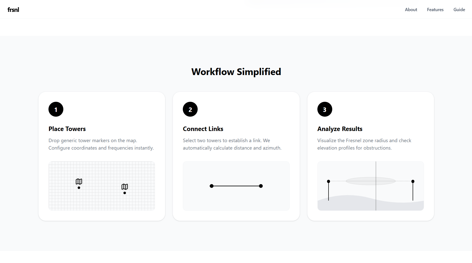
This web-based tool is designed for planning simple point-to-point radio frequency (RF) links between towers on an interactive map. It serves as a practical utility for visualizing how towers communicate based on their geographic positions and technical configurations.
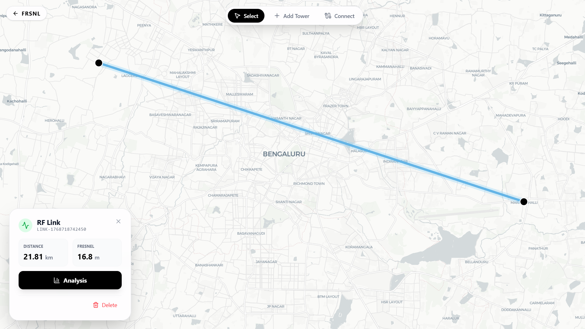
Core features include the ability to place towers with specific frequencies and draw links between them, provided their frequencies match. Users can interact with the map to precisely position equipment and analyze the distance and frequency of each link.
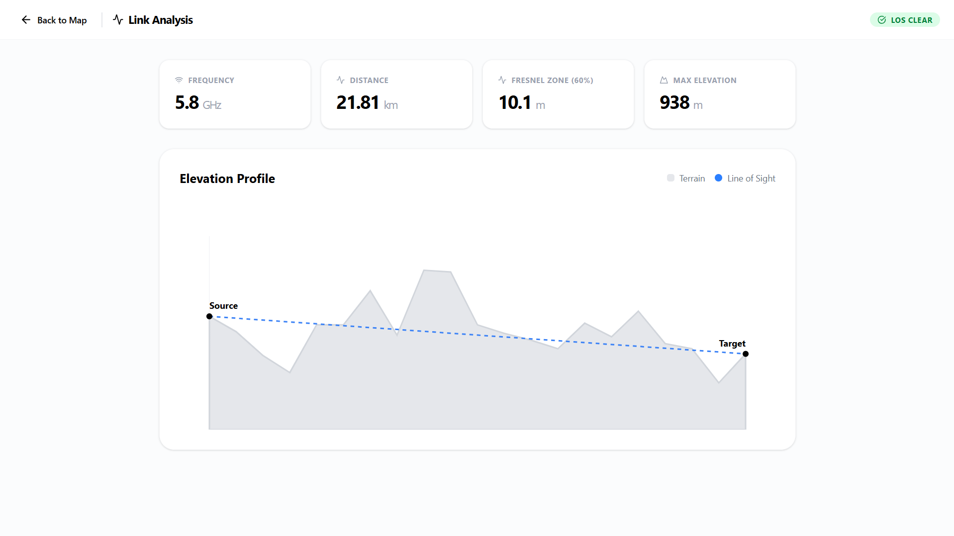
A standout feature is the visualization of the first Fresnel zone as an ellipse around the link, which helps identify potential terrain obstructions. The tool integrates with elevation APIs to fetch terrain data and calculate clearance requirements.
The frontend is implemented using React and Leaflet for map interactions, styled with Tailwind CSS for a minimalist and high-contrast user interface. It handles complex geometric calculations entirely on the client side to provide immediate visual feedback.
All designs on this website were created by Likith Raj. Some of the featured works are conceptual pieces and may not represent real products.
© 2026 Likith Raj. All rights reserved.